• Skip to primary navigation
  • Skip to main content
  • Skip to footer
Arjeploglapland

Arjeploglapland

Beautiful, wild and friendly

  • Events
    • For organizers
  • See & do
    • Activities
    • Rent leisure equipment
    • Shopping
    • Top of Arjeplog
    • Trail guides
    • Meetings & conference
  • Food & Drinks
  • Accommodation
  • Fishing
    • Fishing Center
    • Map of fishing areas
    • Fishing guide (PDF)
  • Practical
    • Getting here
    • Road trip in Arjeplog
    • Snowmobile regulations
    • Interactive Map
    • Webcams
  • Articles
  • Svenska

Discover the least hiked part of Kungsleden

19 August, 2020 by Linnea Eriksson

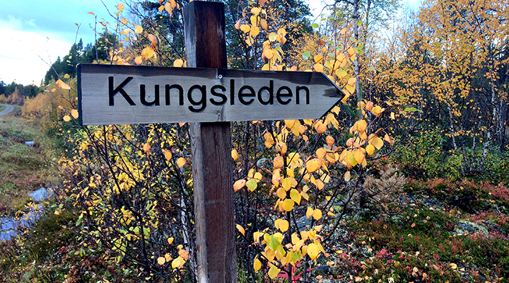
Kungsleden, The King’s Trail, is a hiking trail in northern Sweden, approximately 440 kilometres (270 miles) long, between Abisko in the north and Hemavan in the south. It passes through one of Europe’s largest remaining wilderness areas.

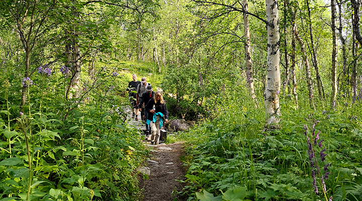
The section between Kvikkjokk and Ammarnäs is the least hiked on Kungsleden. Perhaps because a tent is needed and the nature is comprised more of mountain birch forests and river valleys than bare mountain region. But the views over the large forests are majestic, especially in Pieljekaise National Park.

August and beginning of September are the best months, when the landscape is painted a golden red and the mosquitoes disappear.

The hike can be demanding due to the path going up and down. Between the river valleys and plateaus are several hundred meters of altitude change. Several smaller communities, huts and cottages give the area its own character, unlike anything else on Kungsleden. This section also means somewhat longer boat transports, which you can arrange (for example from Voutnatjviken).

There are a few simpler cabins, such as Tsielejåkk and Pieljakaise cabins, where you can sleep if you arrange to recieve a key. You can overnight in the village of Jäckvik, Adolfström and Bäverholm, but you will overnight most of the time in a tent or the typical lean-to shelter. If the weather is good, the mountain plateaus offer the best tent spots.

The Svaipa bird preservation area is worth an extra stop for ornithologists, and the hike over the prairie-like flat country of Björkfjäll expands the views. The final stretch to Ammarnäs takes place over a long ridge that offers a fantastic view of the river valley.

Facts from STF‚ Svenska Turistföreningen, comprised and translated by Maria Söderberg.

Category iconNature experiences

Footer

Tourist information

Get personal service and information about Arjeplog.

+46 (0)961-145 20

turist@arjeplog.se

Torget 1
938 31 Arjeplog

Read and download the summer brochure

  • Facebook
  • Instagram
  • YouTube

© 2023 Arjeplog Lapland.

This website uses cookies to improve your experience. ACCEPT
Privacy & Cookies Policy

Privacy Overview

This website uses cookies to improve your experience while you navigate through the website. Out of these cookies, the cookies that are categorized as necessary are stored on your browser as they are as essential for the working of basic functionalities of the website. We also use third-party cookies that help us analyze and understand how you use this website. These cookies will be stored in your browser only with your consent. You also have the option to opt-out of these cookies. But opting out of some of these cookies may have an effect on your browsing experience.
Necessary
Always Enabled
Necessary cookies are absolutely essential for the website to function properly. This category only includes cookies that ensures basic functionalities and security features of the website. These cookies do not store any personal information.
SAVE & ACCEPT